
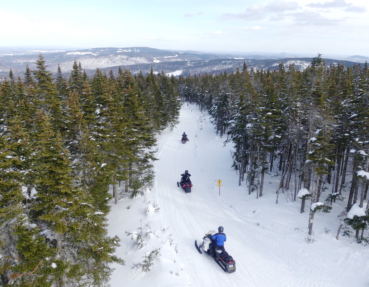
Discover Southern Quebec Day Loops…
Related: Chaudière Appalaches Fast Facts
Check out everything you need to know about how to plan & do a saddlebag tour!
For many riders, my Chaudière Appalaches snowmobile planner involves a major paradigm shift. That’s because going snowmobiling typically means heading north.
For snowmobilers, this also means looking for snow above the St. Lawrence River. And certainly, that’s where many great FCMQ trails can be found. But those who focus all their attention there are missing some of the best snowmobiling in La Belle Province.
About The Region
I’m referring to the Chaudière-Appalaches Region, located south of The City of Québec and below the river. The region gets its name from the Chaudière River that bisects it from north to south. And also from the Appalachian Mountains. They run from southwest to northeast through it, paralleling Québec’s international border with the State of Maine.
Together, these two geological characteristics also define snowmobiling in Chaudière-Appalaches. Their trails combine a unique blend of highlands and river valleys. Along with, rolling foothills and lowland plateaus, they deliver many diverse days of remarkable trail riding.

Map courtesy of Wikipedia
That’s why I keep returning to go snowmobiling in the region. And why I’ve prepared this Chaudière Appalaches snowmobile ride planner for you. In fact at last count, my past winter’s tour there was my sixth visit. Some of these show up as previous articles on my Intrepid Snowmobiler website.
And if you need more proof about Chaudière-Appalaches than that, just ask yourself. Why do hundreds of Americans snowmobile north every winter from Maine to ride this snowy region?
Chaudière Appalaches Snowmobile Planner Trail Map
Their presence likely also explains why the distances marked on the Chaudière-Appalaches Trail Map are in miles, not kilometres. So be careful when route planning with this map. Either do the conversions on your calculator or do your advance distance additions using the FCMQ Interactive Trail Map.
But rest assured. Once on the snow, all of the distances posted on their trail signs are in kilometres, which is good the metric-minded. But it must be confusing for American visitors following the map in miles.
Speaking of the Chaudière-Appalaches map. It’s the only one I’ve ever used that’s printed on a water and tear proof material. So unlike most other print maps, this makes it reliable and durable for multi-day rides, just like their snowmobile trails!
Chaudière Appalaches Snowmobile Planner: Saddle Bag Tours
On my various Chaudière-Appalaches tours, I’ve done several saddlebag rides. I’ve staged out of Thetford Mines (Comfort Inn), Lévis (Normandin Hotel & Suites) and Montmagny (Econo Lodge & Suites). That’s because Chaudière-Appalaches and its Centre-du-Québec Region trail map partner offer over 4,000 kilometres of groomed trails, So between them, there are lots of multi-day riding options between Drummondville in the west and Tourville to the east.

Photo by Al Fletcher
Chaudière Appalaches Snowmobile Planner: Day Ride Tours
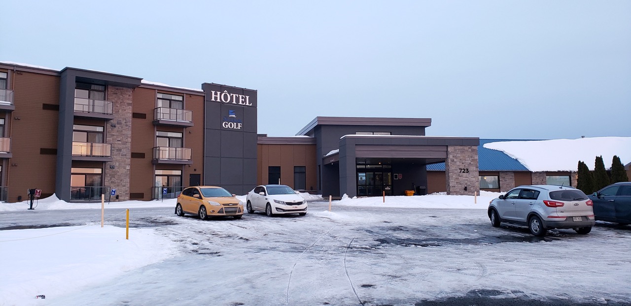
I’ve also done day loops staying at the same lodgings for several nights. I’ve based out of both Sainte-Marie (Motel Invitation) and Lac-Etchemin (Manoir Lac-Etchemin). But this time, we headed for The Beauce Region for our three days of riding. There, we staged out of the very contemporary Hotel La Cache de Golf in Beauceville.
Its location is near the intersection of Trans Quebec Trails 55 & 75. This positioning provides excellent trail access to three loops designated on the Chaudière-Appalaches Trail Map. To the south, you can enjoy the 265-kilomotre La Beauce & Etchemin Counties Loop around the town of Saint-Georges. Westward you’ll discover the 238-kilometre In Between Loop that circles Thetford Mines.
And eastbound, you can ride The Sugar Bushes Loop that passes Lac-Etchemin, Montmagny and Saint-Marie. This last one’s a long day’s ride at 375 kilometres. But as you’ll soon see, you can cut it shorter.
Even The Best Laid Plans…
It’s a fact of snowmobiling. You never know for certain what the weather will be for any planned ride. For this visit to Chaudière-Appalaches, we experienced some sun on day one and a major snow storm on day three. Here’s how it went…

Our 3 day loops marked in black.
Day One
On day one, we did the western part of The Sugar Bushes Loop. But as noted, we cut it down to 236 kilometres. We did so by taking Regional Trails 549 and 547 around the high terrain of Parc régional du Massif du Sud. This shorter route allowed us to visit both panoramic lookouts at Mount Saint-Magloire and Mount-du-Midi.
Mount Sainte-Magloire lookout photo © by Craig Nicholson
Fortunately, skies were bright blue and visibility so clear that we could see to the horizon. We even spotted the Mont Sainte-Anne ski slopes many kilometres north on the other side of the St. Lawrence!
Day Two
Next day, we did 213 kilometres on the southern part of The Beauce and Etchemin Counties Loop. This took us almost to Maine. On route, we passed through active deer yards near Saint-Georges on Trans Québec Trail 75 and Armstrong/Saint-Théophile on Trans Québec Trail 25.
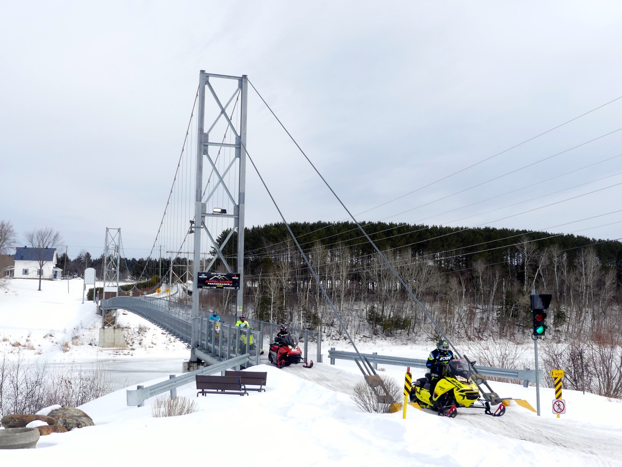
Saint-Martin Suspension Bridge photo © by Craig Nicholson
In addition, we crossed two major bridges. The Saint-Martin Suspension Bridge traverses the Chaudière River. Meanwhile, the Linière-Marlow Bridge crosses the Rivière-du-Loup near Saint-Théophile. Both overpasses are on Trans Quebec 25.

Norte-Dame-des-Pins Covered Bridge photo © by Craig Nicholson
Later on Trans Québec Trail 55, we came to my favourite bridge. But surprisingly, we had to ride under it across the Chaudière River ice. I say “under” because this Norte-Dame-des-Pins bridge, the longest covered one in Québec at 505 feet, in now closed. Built in 1929, I guess it’s seen better days and is now unfortunately shut to all recreational usage.
Day Three
As it happened, we had an unexpected experience on our final day of snowmobiling. Under a winter storm warning, we decided to head north towards Lévis on the St. Lawrence. This route allowed us several options to cut our loop shorter if necessary.
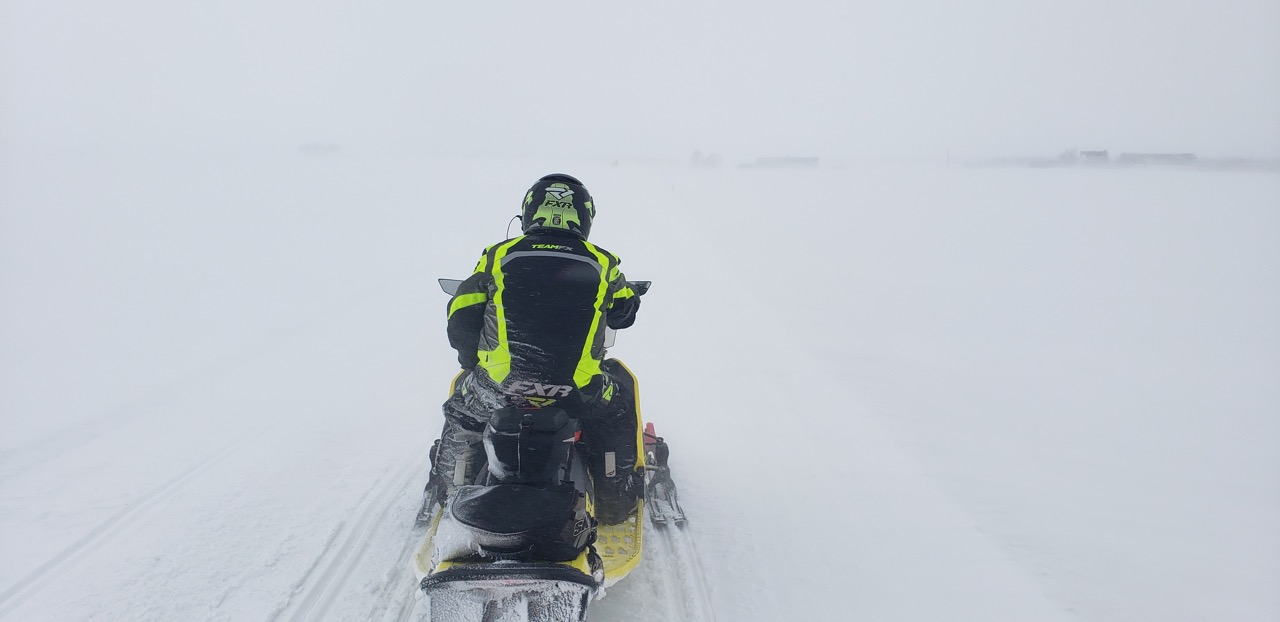
Trail whiteout photo by Al Fletcher
Good choice, because by mid-morning, we’d encountered blinding, blizzardy conditions with blowing snow and white-outs. These, plus many wind-blown trees down across the trails, made pathfinding more difficult and slower than usual. Detour time!
Thanks to well-groomed trails, good signage and lots of well-placed field stakes we persevered. About 220 kilometres later, we arrived back at our hotel just before dark. Fortunately, everyone was riding current sleds with good fuel economy. Good thing, because by the time we wanted to top up about midday as we normally do, all the roads were closed. As a result, any gas stations we spotted has also locked their doors. Now that’s one good reason for always carrying extra gas with you while snowmobiling!
More Good Reasons To Visit Chaudière Appalaches
These unusual closures aside, trail accessible services and amenities are plentiful in Chaudière-Appalaches. This includes many good lunch stops listed on their trail map. If they are all as tasty as the homemade meals we enjoyed on our midday breaks, you won’t be disappointed.
Meanwhile, don’t be concerned about your oil supply on tour. Or if you need unexpected repairs. That’s because all four manufacturers have dealers conveniently located throughout the region.
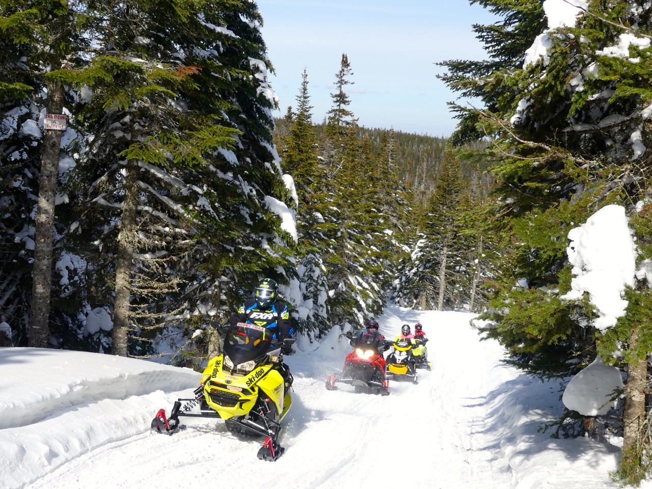
Chaudière Appalaches trail photo © by Craig Nicholson
We had five experienced touring snowmobilers on this ride. And we all agreed that Chaudière-Appalaches delivered a genuinely memorable experience. With trails as good as anywhere else in Québec, be sure to include this exceptional region in your snowmobiling plans as soon as possible.
And that means starting to use my Chaudière Appalaches snowmobile ride planner to get you started. Who knows, we may even cross paths, because you can bet I’ll be returning to Chaudière-Appalaches again in the near future!
Chaudière Appalaches Snowmobile Planner – Where We Stayed Hotel
La Cache du Golf, Beauceville
As the name indicates, this 3-floor, 36-suite hotel is secluded on a golf course. So in the winter, it embraces snowmobilers as eagerly as it welcome golfers in the summer. Their hospitality starts with direct trail access from their signs at Local Trail 774 where it intersects with both Trans Québec Trails 55 and 75. Next up, this trail leads to both the front door and reception desk, or around the back to the secure entrance to interior sled parking under the hotel.
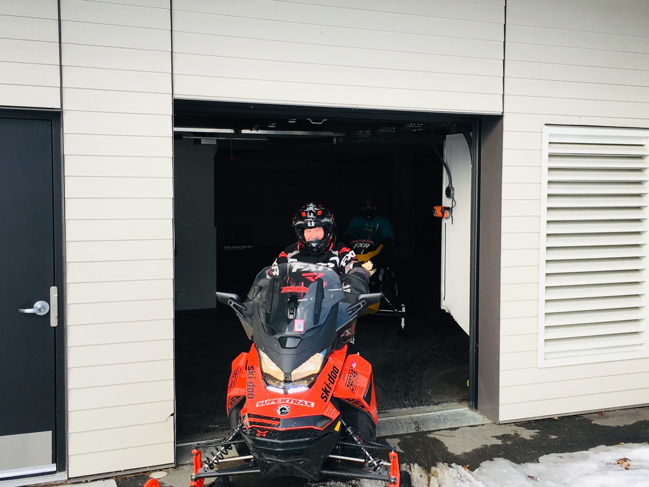
Under hotel parking entrance photo © by Craig Nicholson
What’s more, the first 30 feet or so are covered with rubber matting to prevent carbide scraping, and there’s even multiple sets of dollies available to easily roll your sled to its spot for the night. Finally, transfer your saddlebags to your room using a luggage dolly on the elevator to the parking garage.
Hotel Amenities
As a staging location, the Hotel La Cache du Golf, presents guests with the sleekest, most ultra-modern design of any snowmobiling lodgings I’ve stayed at. Guest suites are spacious, with super comfortable beds, a lounge area and a huge bathroom with lots of counter space.
Other snowmobiler-friendly amenities include hardwood floors, plenty of overhead lighting and electrical outlets, lots of hangers and drawers and shelves. They also provide a mini fridge, Nespresso machine and good Wi-Fi.
One really neat touch is related to the large flat screen TV. It’s mounted on one side of a divider between the separate bedroom and lounge areas. But no problem, that entire partition swivels so you can watch television easily from either room!
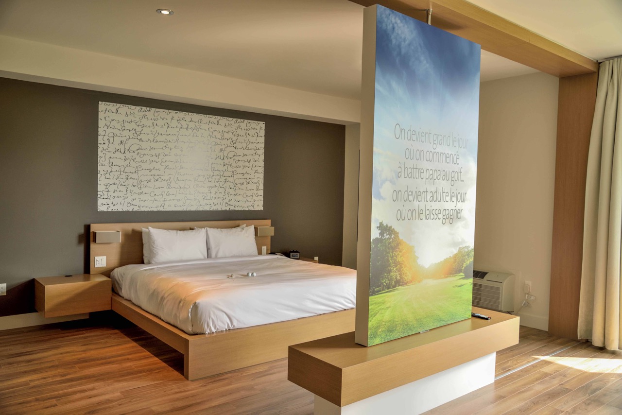
Swivel divider with TV facing bedroom area
Menu Uncertainty
For staying over multiple nights, my only issue with La Cache du Golf was about the on-site La Cachette Restaurant. Don’t get me wrong, the food was good and the service friendly. Plus, breakfast stated at 7 AM.
But the restaurant didn’t seem to have its act together regarding the dinner menu. It varied inexplicably night to night from very limited choice of pub grub to a wide range of full dinner options. Oh well, at least we weren’t starving. And for a one-night stay, we wouldn’t even have known the difference!
More To Like
Hotel photo by Al Fletcher
Road access to Hotel La Cache du Golf is by leaving Highway 73 at the Route du Golf exit. Then, driving east for a couple of kilometres. On arrival, the hotel offers plenty of truck and trailer parking for the duration of your stay near the front entrance.
While there’s no gas on site, fuel is available at a nearby clubhouse, located at the intersection of Trans Québec Trails 55 and 75. You can’t miss it, both trails lead past the pumps!
Add in a snowmobile package that includes breakfast, and all in all I’d highly recommend using Hotel La Cache du Golf as your staging base for day loop rides in Chaudière-Appalaches!
Chaudière Appalaches Snowmobile Planner Websites
Looking for more? Go to my Central Quebec Snowmobile Planner to get more info, contacts and links to organize your own ride!
Like This Post? Follow Me on Facebook!
The tips and advice in this blog are the opinions of the author, may not work in every situation and are intended only for the convenience and interest of the reader, who has the personal responsibility to confirm the validity, accuracy and relevancy of this information prior to putting it to their own use.