
One-Stop Resource for Mauricie, Centre-du-Quebec, Quebec (city & area), Chaudière-Appalaches & Saguenay-Lac-Saint-Jean…
Related: Western Quebec Snowmobile Planner & Eastern Quebec Snowmobile Planner
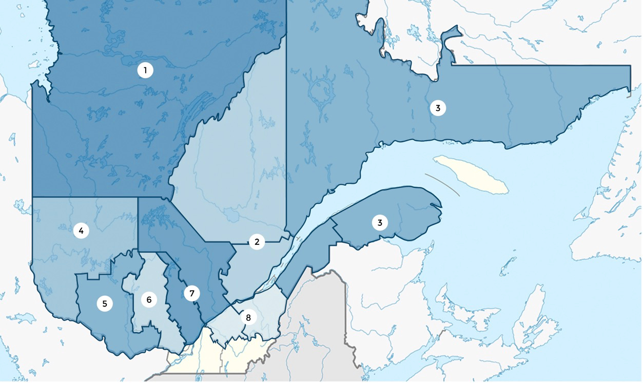
This Central Quebec snowmobile planner provides info, links, contacts, tour articles & itineraries. These are all the basic resources for visiting snowmobilers to get started riding the snowmobile trails operated by the Quebec Federation of Snowmobile Clubs (FCMQ) in Mauricie, Centre-du-Quebec, Quebec (city & area), Chaudière-Appalaches & Saguenay-Lac-Saint-Jean (listed below from west to east).
With the advantage of the most northerly positioning of any mainland Canadian province, plus many areas with high elevation, La Belle Province is a unique and must-do snowmobile destination.
Its 33,000 km (20,500 mi) interconnected trail network runs through many of Quebec’s 20 tourism regions.
But so many trails and so many regions can make discovering and deciding where to go difficult. That’s why it’s valuable to have my western, central and eastern Quebec snowmobile planners at your fingertips – but remember, I’ve only listed the 13 most popular Quebec tourism regions, ones with the most reliable snow that I’ve toured and written about!
Central Quebec Snowmobile Planner
Check out everything you need to know about how to plan & do a saddlebag tour!
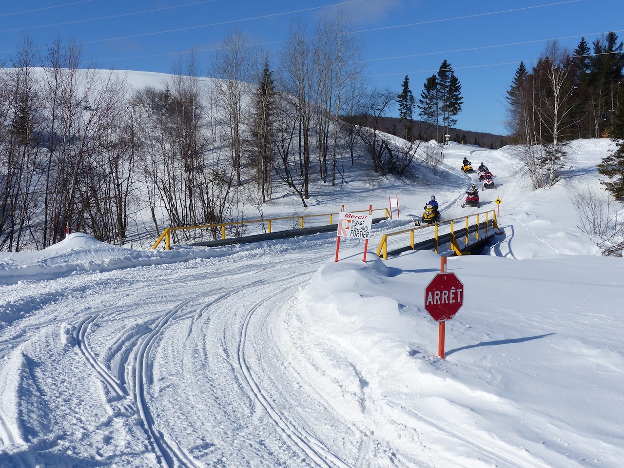
Mauricie (western part of #7 on region map above)
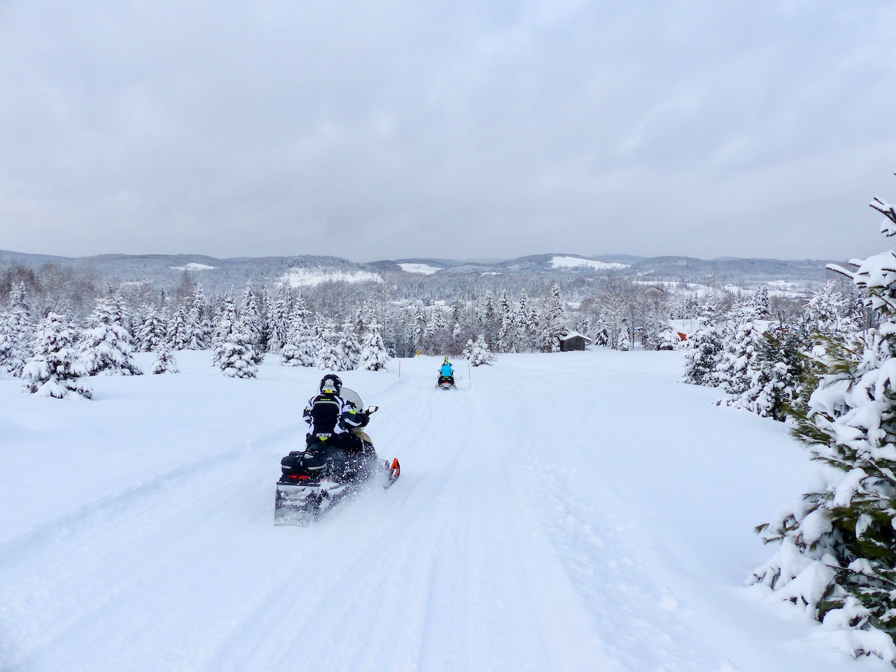
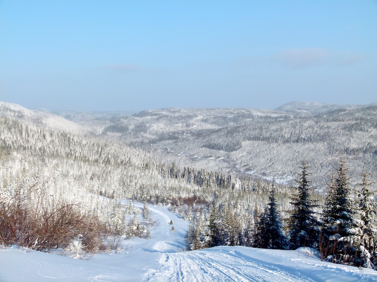
Central Quebec snowmobile planner: Mauricie (photo © Craig Nicholson).
Location: This large central region stretches all the way from Trois-Rivières on the St. Lawrence River north through higher central elevations and into its northwestern taiga. The Mauricie Region’s approximately 1,955 km (1,215 mi) of trails provide day loop opportunities in the more populated south and remote wilderness saddlebag adventures in the north as you will discover in my Central Quebec snowmobile planner. 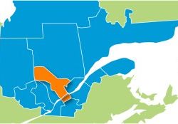
Neighbouring Regions Connected by Trail: Lanaudière (west), Quebec city & area (east), Saguenay-Lac-Saint-Jean (northeast).
Fav Snowmobile-Friendly & Trail Accessible Centres: Clova, Grand-Mère, La Tuque, Parent, Trois-Rives, Saint-Alexis-des-Monts, Shawinigan.
Season Length: Southern end: January to March. Northern End: December to end of March.
Planning Sites (co-marketed with Lanaudière Region): Snowmobile Country, Quebec Authentic, Bonjour Quebec.
Trail Map: print map file.
Named Loops: yes (10), including into Lanaudière (scroll down linked page to see).
Tour Articles: Mauricie day loops.
Centre-du-Quebec (western part of #8 on region map above)
Central Quebec snowmobile planner: Centre-du-Quebec (photo © Craig Nicholson).
Location: Located on the south side of the St. Lawrence River valley directly opposite Trois-Rivières, the Centre-du-Quebec offers about 1,269 km (789 mi) of trails on the St. Lawrence lowlands along that river’s shore plain and inland towards the more rolling terrain of Appalachian Mountain foothills to the south. The region is suitable for day trips or for staging eastbound saddlebag tours.
Neighbouring Regions Connected by Trail: Chaudière-Appalaches (east), Mauricie Region (north – across the St. Lawrence and not connected by trail).
Fav Snowmobile-Friendly & Trail Accessible Centres: Saint-Ferdinand, Victoriaville.
Season Length: January to March.
Planning Sites (co-marketed with Chaudière-Appalaches Region): Tourisme Centre-du-Quebec, Bonjour Quebec.
Trail Map: print map file.
Named Loops: yes (4) – (scroll to bottom of linked page)
Tour Articles: Centre-du-Quebec/Chaudière-Appalaches saddlebag ride.
Itineraries: Centre-du-Quebec, Chaudière-Appalaches saddlebag loop.
Quebec – city & area (southern part of #2 on region map above)
Central Quebec snowmobile planner: Quebec (city & area) (photo © Craig Nicholson).
Location: The City of Quebec is the capital of Quebec and so has a tourism region all its own. Its compact area runs from the St. Lawrence River lowlands north through the Canadian Shield. Trans Quebec Trail 3 runs across the north end of the city, but there’s no trail access to the main urban area. With a limited number of trails, the region is suitable for local day trips, while serving as the gateway for staging north or eastbound saddlebag tours.
Neighbouring Regions Connected by Trail: Charlevoix (east), Mauricie (west), Saguenay-Lac-Saint-Jean (north) & Chaudière-Appalaches (south, across the St. Lawrence with no trail access, except by sled shuttle). 
Fav Snowmobile-Friendly & Trail Accessible Centres: L’Étape, Quebec, Portneuf, Sainte-Anne-de-Beaupré, Saint-Raymond.
Season Length: North end – Late December to end of March. South end – January to March.
Planning Sites: Tourisme Quebec, Bonjour Quebec.
Trail Map: paper map file.
Named Loops: not that I could find.
Tour Articles: Quebec City/La Malbaie ride.
Itineraries: Quebec City/Charlevoix loop, Quebec City/Charlevoix/Saguenay loop.
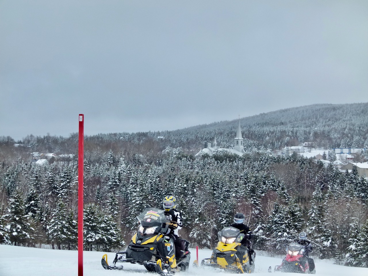
Chaudière-Appalaches (eastern part of #8 on region map above)
Central Quebec snowmobile planner: Chaudière-Appalaches (photo © Craig Nicholson).
Location: Named for the Chaudière River and Appalachian Mountains that run through it, the Chaudière-Appalaches Region is located on the south side of the St. Lawrence River valley, directly across from the City of Quebec. It’s a mirror image of regions on the north side of the St. Lawrence in that its approximately 2,654 km (1,650 mi) of trails run through shore lowlands at the region’s north end and higher elevations in the Appalachians to its south central area. The region is large enough to enable saddle bag tours and plenty of good day looping options that you will find with my Central Quebec snowmobile planner.
Neighbouring Regions Connected by Trail: Bas-Saint-Laurent (northeast), Centre-du-Quebec (west) & State of Maine (southeast). 
Fav Snowmobile-Friendly & Trail Accessible Centres: Lac-Etchemin, Lévis, Saint-Georges, Sainte-Marie, Montmagny, Thetford Mines.
Season Length: Central /south area – Late December to end of March. North along St. Lawrence – January to March.
Planning Sites (co-marketed with Centre-du-Quebec Region): Tourisme Chaudière-Appalaches, Bonjour Quebec.
Trail Map: print map file & interactive file
Named Loops: yes 6 + 1 multi-region
Tour Articles: day loop rides from Beauceville, day loops from Saint-Marie, Centre-du-Quebec/Chaudière-Appalaches saddlebag ride.
Itineraries: Riding Chaudière-Appalaches, Chaudière-Appalaches/Centre-du-Quebec saddlebag loop.
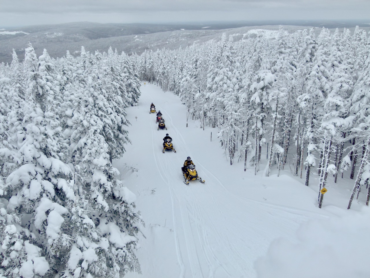
Saguenay-Lac-Saint-Jean (northern part of #2 on region map above)
Central Quebec snowmobile planner: Saguenay-Lac-Saint-Jean (photo © Craig Nicholson).
Location: With about 3,851 km (2,393 mi) of trails, Saguenay-Lac-Saint-Jean is dominated by the west to east running Saguenay Fiord, which splits the region in two north-south on its way to drain into the St. Lawrence River at Tadoussac. The north side is more remote with the snowy Monts-Valin area on the east and the more moderately elevated area north of Lac-Saint John on the west while the main population centres of Saguenay-Lac-Saint-Jean are on the less rugged southside of the Saguenay Fiord. The region offers excellent opportunities for saddle bag tours, day loops from one hotel, plus backcountry riding in Monts-Valin. So why not get started with my Central Quebec snowmobile planner?
Neighbouring Regions Connected by Trail: Baie-James (north – Chapais and Chibougamau are popular destinations for riders heading north from Saguenay-Lac-Saint-Jean), Cote-Nord (east), Mauricie, Quebec & Charlevoix (south).
Fav Snowmobile-Friendly & Trail Accessible Centres: Alma, Chicoutimi, Dolbeau,-Mistassini, Roberval, Sacré-Coeur, Saint-Félicien, Saguenay, Tadoussac. 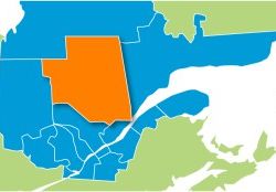
Season Length: Monts-Valin – Mid-November to mid-April. South side of Saguenay River – Late December to end of March.
Planning Site: Tourisme Saguenay-Lac-Saint-Jean, Bonjour Quebec.
Trail Map: print map file, interactive map.
Named Loops: yes (10).
Tour Articles: Day rides from Saguenay, More day loops from Saguenay, Riding Monts-Valin.
Itineraries: Day loops from Saguenay, Monts-Valin, Saddlebag ride from Quebec City.
Learn about Quebec snowmobiler rescue on FCMQ trails.
Like This Post? Follow Me on Facebook
The tips and advice in this blog are the opinions of the author, may not work in every situation and are intended only for the convenience and interest of the reader, who has the personal responsibility to confirm the validity, accuracy and relevancy of this information prior to putting it to their own use.