
Why Printed Maps Are Getting Harder To Find…
Related: Choose Your Type of Ride
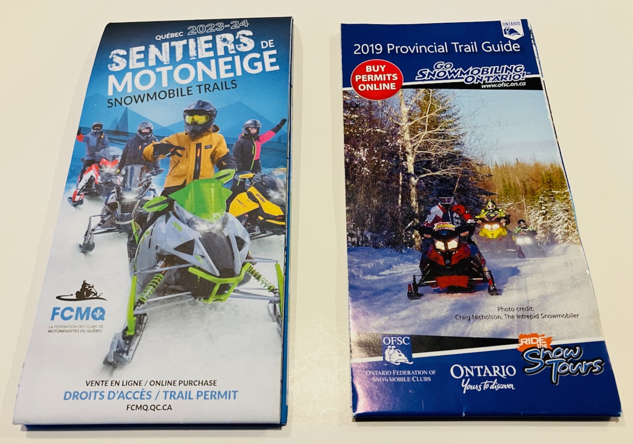
Paper Snowmobile Trail Maps – Quebec
Sledders going to snowmobile shows to pick up paper snowmobile trail maps from Quebec are disappointed. Effective 2024, La Fédération des Clubs de Motoneigistes du Québec (FCMQ) decided to stop printing the only paper map it is responsible for.
The two-sided Quebec Snowmobile Trail Map showed every trail and all regions side by each. Instead of printing, the Federation invested the dollars saved into upgrades to its online interactive trail map and also continues major updates of its backend mapping technology.
Meanwhile, the availability of Quebec regional trail maps is decreasing. These printed maps are the responsibility of each tourism region, and many have already decided to limit or stop publishing paper maps. So, showgoers may still be able to get some regional printed trail maps, but they too will soon be extinct.
Paper Snowmobile Trail Maps – Ontario
The FCMQ stop-print decision mirrors a similar one made previously by the Ontario Federation of Snowmobile Clubs (OFSC). Prior to the 2020 season, the OFSC ceased publication of its Trans Ontario Provincial (TOP) Trail Guide in favour of an Interactive Trail Guide. As for paper snowmobile trail maps from districts in Ontario, they are the responsibility of each OFSC District (using guidelines provided by the OFSC). So, it’s a district decision to continue, limit or stop printing their own trail map. As of this writing, less than half of districts continue to issue one.
Why Is This Happening?
However, be it Quebec or Ontario, the reasons for re-evaluating print decisions are much the same. These include the inability to change paper snowmobile trail maps after printing, even though many trail adjustments always occur after publishing for a variety of reasons. Like trails closed for logging, construction, infrastructure damage, trespass, etc. This print discrepancy can be a serious liability issue. It can also cause problems among landowners who have not yet given trail permission. Or decide to move the trail location after printing. Or who cancel land use permission for a trail already showing on a print map. Whatever the case, trails showing in print that are not there any more isn’t good for riders. Nor is a print map with no trails showing in some areas at the time of print that become available later.
Then there’s the rising cost, volunteer effort and time commitment of producing a paper map. Or the increasing difficulty of getting paid advertising, which provides funding for map costs. And is supposed to be a revenue generator for the district. Without advertisers, printing maps is simply too costly, when scarce dollars are needed for trail-related operations.
Then there’s the shortage of free distribution outlets, now that permits sales have gone online. Plus, with the ongoing digitalization of snowmobiling with sleds having increasingly sophisticated interactive display capabilities. To say nothing of a younger generation of riders who hardly know what paper is anymore, except in the bathroom.
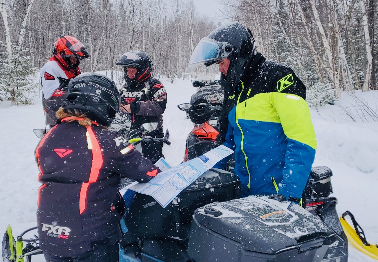
Sure, most of us who’ve snowmobiled for many years still love our printed trail maps. But just as we can no longer get telephone books or as many published newspapers, printed snowmobile trail maps are gradually becoming extinct.
My Last Word
So, I guess it’s high time to come up with another reason to attend a snowmobile show. How about all that new sled tech? Or chatting with snowmobile district and club volunteers? Checking out new gear? Or connecting with tourism folks and hospitality providers? And best of all – having the rare opportunity to mingle with so many others who share our passion for trail riding. Even if we can’t get any paper snowmobile trail maps to help plan our trips…
Which brings me to the importance of online trail guides. They can be updated regularly whenever and wherever any trail changes. Meanwhile, they’re interactive and provide more relevant & accurate info than a paper map ever could. And available apps can ride along with you. Plus, digital maps don’t get torn, mushy-wet or hard to read after dark like paper maps did. And there are still plenty of trail signs to aid with easier wayfinding!
Like This Post? Follow Me on Facebook!
The tips and advice in this blog are the opinions of the author, may not work in every situation and are intended only for the convenience and interest of the reader, who has the personal responsibility to confirm the validity, accuracy and relevancy of this information prior to putting it to their own use.